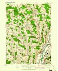
1942 Map of Castle Creek
USGS Topo · Published 1960About this map
The Chenango River valley serves as a primary corridor for settlement and transit north of Binghamton on this 1930s-era survey. The landscape transitions from the riverfront communities of Port Dickinson and Hillcrest into a series of rolling hills and creek valleys, where smaller hamlets like Castle Creek and Choconut Center are established. A dense network of rural one-room schoolhouses, including Puffer Sch, Black Sch, and Dimmock Sch, reflects a dispersed agricultural population during this period. Local history is deeply embedded in the terrain through family-named peaks like Deyo Hill and Wilson Hill, while the Polish Cem and Calvary Cem hint at the diverse immigrant communities that shaped the region. Notable infrastructure of the time, such as the Airway Beacon and the Delaware and Lackawanna railroad lines, highlights the area's role in the broader regional transportation network.
Find a feature on this map
62 named features on this map. Tap any name to fly to it.
Don’t see what you’re looking for? This feature index may not catch every label — zoom into the map to look around manually.
Map Details
Editions of this 1942 Castle Creek Map
3 editions found

Other maps of this area

1901 · Apalachin
USGS Topo · 1:62,500

1903 · Harford
USGS Topo · 1:62,500

1904 · Binghamton
USGS Topo · 1:62,500

1904 · Greene
USGS Topo · 1:62,500

1904 · Apalachin
USGS Topo · 1:62,500

1906 · Catatonk
USGS Topo · 1:125,000

1934 · Castle Creek
USGS Topo · 1:24,000

1935 · Binghamton West
USGS Topo · 1:24,000

1935 · Chenango Forks
USGS Topo · 1:24,000

1937 · Binghamton East
USGS Topo · 1:24,000