
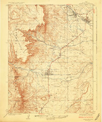
1925 Map of Castle Dale
USGS Topo · Published 1925About this map
Castle Dale and Orangeville anchor this mid-1920s survey of the San Rafael Swell's western edge, where irrigation and coal mining shaped the Emery County landscape. The map captures the early development of the Mormon Corridor, showing the tight grid layouts of Ferron and Clawson alongside the extensive network of ditches like Blue Ditch that brought water from Cottonwood Creek and Ferron Creek to the high benches.
Find a feature on this map
42 named features on this map. Tap any name to fly to it.
Don’t see what you’re looking for? This feature index may not catch every label — zoom into the map to look around manually.
Map Details
Editions of this 1925 Castle Dale Map
2 editions found
Other maps of this area

1885 · San Rafael
USGS Topo · 1:250,000

1885 · Manti
USGS Topo · 1:250,000

1885 · Fish Lake
USGS Topo · 1:250,000

1886 · Price River
USGS Topo · 1:250,000

1895 · Manti
USGS Topo · 1:250,000

1896 · Price River
USGS Topo · 1:250,000

1896 · Fish Lake
USGS Topo · 1:250,000

1922 · Wasatch
USGS Topo · 1:31,680

1923 · Castle Dale
USGS Topo · 1:62,500

1923 · Hiawatha
USGS Topo · 1:62,500