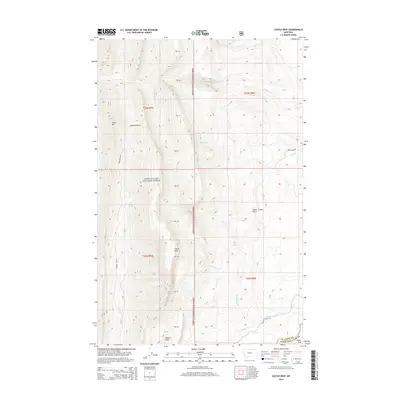
2014 Map of Castle Reef
USGS Topo · Published 2014About this map
Lewis & Clark National Forest dominates this landscape, where the Front Range meets the plains of the Teton and Lewis and Clark County line. The dramatic elevation changes are centered on Castle Reef and Grass Hill, with steep drainages such as Hannan Gulch and Green Timber Gulch carving through the limestone formations. Water management is a primary feature of the lower elevations, where the Pishkun Canal diverts water along the base of the mountains toward the Sun River. This irrigation infrastructure, including the Pishkun Canal Rd, highlights the transition from protected wilderness to the managed agricultural lands of the Alkali Flat. Remote drainages like Richardson Cr and No Business Cr underscore the isolated nature of these headwaters before they emerge from the forest boundary into the open Montana basin.
Find a feature on this map
24 named features on this map. Tap any name to fly to it.
Don’t see what you’re looking for? This feature index may not catch every label — zoom into the map to look around manually.
Map Details
Editions of this 2014 Castle Reef Map
This is the sole edition of this map. No revisions or reprints were ever made.
Other maps of this area

1903 · Saypo
USGS Topo · 1:125,000

1955 · Choteau
USGS Topo · 1:250,000

1957 · Choteau
USGS Topo · 1:250,000

1958 · Choteau
USGS Topo · 1:250,000

1958 · Ear Mountain
USGS Topo · 1:24,000

1958 · Lake Theboe
USGS Topo · 1:24,000

1958 · Our Lake
USGS Topo · 1:24,000

1958 · Barr Creek
USGS Topo · 1:24,000

1958 · Sawtooth Ridge
USGS Topo · 1:24,000

1958 · Patricks Basin
USGS Topo · 1:24,000