
1958 Map of Our Lake
USGS Topo · Published 1959About this map
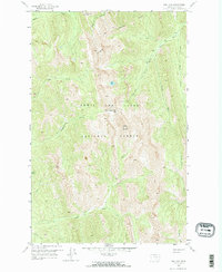
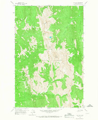
Rocky Mountain and Old Baldy dominate the high-altitude terrain of the Lewis and Clark National Forest in this late 1950s survey. The landscape is defined by the sharp divides between the Teton River and Deep Creek watersheds, where primary access was maintained through established mountain crossings like Headquarters Pass and Route Creek Pass. Evidence of high-country management is visible at Beartop Lookout, situated on a prominent peak overlooking the drainage systems of Dryden Creek and Lynx Creek. The hydrology is complex, with high-elevation water bodies like Our Lake feeding into narrow canyons and gulches. The prominence of a Pack Trail network instead of roads highlights the non-motorized, backcountry nature of this region during the post-war era, preserving the topographical detail of landmarks such as Lonesome Ridge and Green Gulch.
Find a feature on this map
23 named features on this map. Tap any name to fly to it.
Don’t see what you’re looking for? This feature index may not catch every label — zoom into the map to look around manually.
Map Details
Editions of this 1958 Our Lake Map
Other maps of this area

1903 · Saypo
USGS Topo · 1:125,000

1955 · Choteau
USGS Topo · 1:250,000

1957 · Choteau
USGS Topo · 1:250,000

1958 · Choteau
USGS Topo · 1:250,000

1958 · Ear Mountain
USGS Topo · 1:24,000

1958 · Cave Mountain
USGS Topo · 1:24,000

1958 · Porphyry Reef
USGS Topo · 1:24,000

1958 · Mount Wright
USGS Topo · 1:24,000

1958 · Glenn Creek
USGS Topo · 1:24,000

1958 · Gates Park
USGS Topo · 1:24,000