
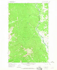
1958 Map of Glenn Creek
USGS Topo · Published 1960About this map
Lewis and Clark National Forest encompasses this high-country landscape, where the confluence of several mountain drainage systems creates a complex network of waterways. The North Fork Sun River serves as a primary corridor, winding through the eastern portion of the sheet near the boundary between Teton Co and Lewis and Clark Co. Historically significant for forest management and back-country access, the Cabin Creek Guard Station and nearby Cabin Bridge mark a rare point of established infrastructure in an area otherwise defined by a winding Pack Trail system. The terrain is dramatically defined by summits like Slategoat Mtn and Sheep Mtn, while the Sun River Game Preserve Bdy highlights the region's long-standing role in wildlife conservation. Smaller features such as Hazard Lake and the Sulphur Creek Lick indicate local landmarks that have guided travelers and rangers for generations.
Find a feature on this map
22 named features on this map. Tap any name to fly to it.
Don’t see what you’re looking for? This feature index may not catch every label — zoom into the map to look around manually.
Map Details
Editions of this 1958 Glenn Creek Map
4 editions found
Other maps of this area

1903 · Saypo
USGS Topo · 1:125,000

1936 · Silvertip
USGS Topo · 1:96,000

1942 · Silvertip
USGS Topo · 1:125,000

1955 · Choteau
USGS Topo · 1:250,000

1957 · Choteau
USGS Topo · 1:250,000

1958 · Choteau
USGS Topo · 1:250,000

1958 · Our Lake
USGS Topo · 1:24,000

1958 · Pretty Prairie
USGS Topo · 1:24,000

1958 · Gates Park
USGS Topo · 1:24,000

1958 · Patricks Basin
USGS Topo · 1:24,000