
1958 Map of Pretty Prairie
USGS Topo · Published 1960About this map
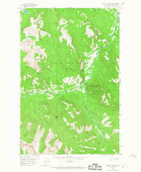
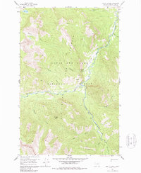
Lewis and Clark National Forest encompasses this wilderness region at the confluence of the South Fork Sun River and the West Fork Sun River. The landscape is defined by the Lewis and Clark Game Preserve, which protects the varied terrain surrounding the mountain drainages of Goat Creek and Elk Creek. Human presence is minimal, centered on administrative and recreational outposts like the Pretty Prairie Guard Sta and Camp Allan.
Find a feature on this map
27 named features on this map. Tap any name to fly to it.
Don’t see what you’re looking for? This feature index may not catch every label — zoom into the map to look around manually.
Map Details
Editions of this 1958 Pretty Prairie Map
3 editions found
Other maps of this area

1902 · Ovando
USGS Topo · 1:125,000

1903 · Saypo
USGS Topo · 1:125,000

1903 · Coopers Lake
USGS Topo · 1:125,000

1905 · Ovando
USGS Topo · 1:125,000

1936 · Silvertip
USGS Topo · 1:96,000

1942 · Silvertip
USGS Topo · 1:125,000

1955 · Choteau
USGS Topo · 1:250,000

1957 · Choteau
USGS Topo · 1:250,000

1958 · Choteau
USGS Topo · 1:250,000

1958 · Glenn Creek
USGS Topo · 1:24,000