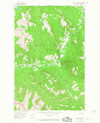
1958 Map of Pretty Prairie
USGS Topo · Published 1967About this map
South Fork Sun River and its various tributaries define this mid-century landscape within the Lewis and Clark National Forest. The geography is shaped by the confluence of the West Fork South Fork Sun River and the main stem, with remote outposts like Camp Allan and the Pretty Prairie Guard Sta serving as the primary human markers. This area, largely designated as a game preserve, is traversed by a network of Pack Trails that connect high points like Deadman Hill to the valley floors.
Find a feature on this map
20 named features on this map. Tap any name to fly to it.
Don’t see what you’re looking for? This feature index may not catch every label — zoom into the map to look around manually.
Map Details
Editions of this 1958 Pretty Prairie Map
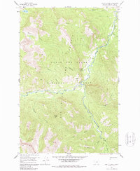
3 editions found

Other maps of this area

1902 · Ovando
USGS Topo · 1:125,000

1903 · Saypo
USGS Topo · 1:125,000

1903 · Coopers Lake
USGS Topo · 1:125,000

1905 · Ovando
USGS Topo · 1:125,000

1936 · Silvertip
USGS Topo · 1:96,000

1942 · Silvertip
USGS Topo · 1:125,000

1955 · Choteau
USGS Topo · 1:250,000

1957 · Choteau
USGS Topo · 1:250,000

1958 · Choteau
USGS Topo · 1:250,000

1958 · Glenn Creek
USGS Topo · 1:24,000