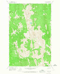
1958 Map of Our Lake
USGS Topo · Published 1967About this map
Lewis and Clark National Forest defines this high-elevation landscape in the late 1950s, centered on the towering summit of Rocky Mountain. This portion of the Front Range reveals a complex network of drainage systems, where the South Fork Teton River and Middle Fork Teton River carve through steep terrain alongside North Fork Deep Creek. The map provides essential detail for navigating this wilderness, documenting established routes such as the Pack Trail that crosses through Headquarters Pass and Route Creek Pass.
Find a feature on this map
21 named features on this map. Tap any name to fly to it.
Don’t see what you’re looking for? This feature index may not catch every label — zoom into the map to look around manually.
Map Details
Editions of this 1958 Our Lake Map
Other maps of this area

1903 · Saypo
USGS Topo · 1:125,000

1955 · Choteau
USGS Topo · 1:250,000

1957 · Choteau
USGS Topo · 1:250,000

1958 · Choteau
USGS Topo · 1:250,000

1958 · Ear Mountain
USGS Topo · 1:24,000

1958 · Cave Mountain
USGS Topo · 1:24,000

1958 · Porphyry Reef
USGS Topo · 1:24,000

1958 · Mount Wright
USGS Topo · 1:24,000

1958 · Our Lake
USGS Topo · 1:24,000

1958 · Glenn Creek
USGS Topo · 1:24,000