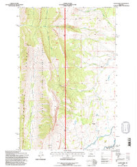
1995 Map of Castle Reef
USGS Topo · Published 1997About this map
The Sawtooth Range and the Castle Reef formation dominate this mountain landscape along the eastern edge of the Lewis and Clark National Forest. Revised in the mid-1990s, this survey documents the rugged drainage systems where the North Fork Deep Creek and South Fork Deep Creek meet. The map reveals the intricate network of gulches and creeks that define the transition from the high peaks down toward the plains, notably including Green Timber Gulch and Hannan Gulch.
Find a feature on this map
19 named features on this map. Tap any name to fly to it.
Don’t see what you’re looking for? This feature index may not catch every label — zoom into the map to look around manually.
Map Details
Editions of this 1995 Castle Reef Map
This is the sole edition of this map. No revisions or reprints were ever made.
Other maps of this area

1903 · Saypo
USGS Topo · 1:125,000

1955 · Choteau
USGS Topo · 1:250,000

1957 · Choteau
USGS Topo · 1:250,000

1958 · Choteau
USGS Topo · 1:250,000

1958 · Ear Mountain
USGS Topo · 1:24,000

1958 · Lake Theboe
USGS Topo · 1:24,000

1958 · Our Lake
USGS Topo · 1:24,000

1958 · Barr Creek
USGS Topo · 1:24,000

1958 · Sawtooth Ridge
USGS Topo · 1:24,000

1958 · Patricks Basin
USGS Topo · 1:24,000