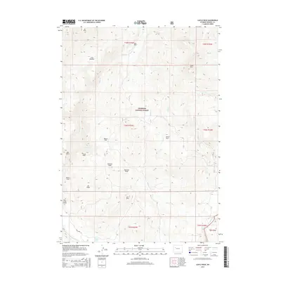
2015 Map of Castle Rock
USGS Topo · Published 2015About this map
Shoshone National Forest defines the rugged high-elevation landscape of this Fremont County quadrangle, situated within the Absaroka Range. The terrain is characterized by dramatic elevation shifts, ranging from the summit of Mt Kent to the deep incisions of Bear Creek Canyon. High-country water features are prominent, including Goose Lake and the drainage of the East Fork Wind River, which flows through the southeastern corner. A network of creeks like Castle Cr, Alkali Cr, and Waynes Cr carve through the ridges and basins. Evidence of land use and navigation is found along Bear Creek Rd, providing access to distinct local landmarks such as Waynes Hole, Bear Basin, and the prominent Castle Rock. This map details the complex drainage patterns and ridgelines of the forest interior before these waters reach the larger Wyoming river systems.
Find a feature on this map
34 named features on this map. Tap any name to fly to it.
Don’t see what you’re looking for? This feature index may not catch every label — zoom into the map to look around manually.
Map Details
Editions of this 2015 Castle Rock Map
This is the sole edition of this map. No revisions or reprints were ever made.
Other maps of this area

1904 · Kirwin
USGS Topo · 1:125,000

1905 · Younts Peak
USGS Topo · 1:125,000

1906 · Kirwin
USGS Topo · 1:125,000

1907 · Younts Peak
USGS Topo · 1:125,000

1955 · Thermopolis
USGS Topo · 1:250,000

1956 · Indian Point
USGS Topo · 1:24,000

1956 · Snow Lake
USGS Topo · 1:24,000

1956 · Mason Draw
USGS Topo · 1:24,000

1958 · Thermopolis
USGS Topo · 1:250,000

1962 · Thermopolis
USGS Topo · 1:250,000