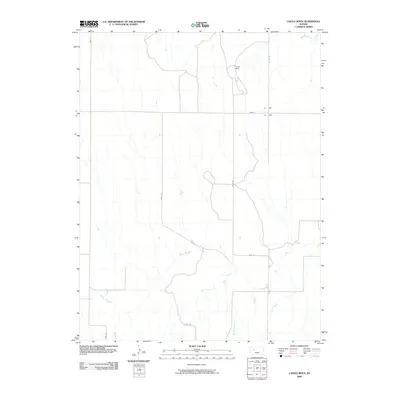
2009 Map of Castle Rock
USGS Topo · Published 2009About this map
Castle Rock stands as the primary landmark in this Gove County landscape, rising above the surrounding plains near the northern edge of the map. The topography is defined by the drainage patterns of the Smoky Hill River, which cuts across the southern half of the quadrangle, joined by tributaries such as Big Windy Creek and Hackberry Creek.
Find a feature on this map
12 named features on this map. Tap any name to fly to it.
Don’t see what you’re looking for? This feature index may not catch every label — zoom into the map to look around manually.
Map Details
Editions of this 2009 Castle Rock Map
This is the sole edition of this map. No revisions or reprints were ever made.
Other maps of this area

1955 · Scott City
USGS Topo · 1:250,000

1958 · Scott City
USGS Topo · 1:250,000

1972 · Gove NE
USGS Topo · 1:24,000

1972 · Castle Rock NW
USGS Topo · 1:24,000
1972 · Castle Rock NE
USGS Topo · 1:24,000

1974 · Gove SE
USGS Topo · 1:24,000

1974 · Castle Rock
USGS Topo · 1:24,000
1974 · Gibson Creek
USGS Topo · 1:24,000

1974 · Pendennis
USGS Topo · 1:24,000
1981 · Arnold
USGS Topo · 1:24,000