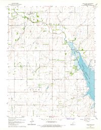
1965 Map of Castleton
USGS Topo · Published 1966About this map
The North Fork Ninnescah River valley undergoes a significant transformation on this mid-1960s sheet as the waters of Cheney Reservoir begin to fill the eastern landscape. This reservoir project, a collaboration involving the U.S. Bureau of Reclamation, altered the traditional rural boundaries where the Albion and Ninnescah townships meet. Along the western edge of the new shoreline, the Cheney State Game Management Area marks a shift toward public conservation and recreation in a previously agricultural and industrial corridor.
Find a feature on this map
21 named features on this map. Tap any name to fly to it.
Don’t see what you’re looking for? This feature index may not catch every label — zoom into the map to look around manually.
Map Details
Editions of this 1965 Castleton Map
2 editions found
Other maps of this area

1889 · Cheney
USGS Topo · 1:125,000

1891 · Cheney
USGS Topo · 1:125,000

1892 · Kingman
USGS Topo · 1:125,000

1894 · Kingman
USGS Topo · 1:125,000

1901 · Cheney
USGS Topo · 1:125,000

1955 · Wichita
USGS Topo · 1:250,000

1955 · Pratt
USGS Topo · 1:250,000

1958 · Wichita
USGS Topo · 1:250,000

1959 · Pratt
USGS Topo · 1:250,000
1961 · Haven
USGS Topo · 1:24,000