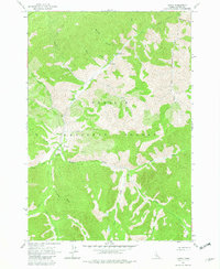
1963 Map of Casto
USGS Topo · Published 1982About this map
Loon Creek winds through the heart of the Challis National Forest, serving as the primary drainage for a landscape defined by deep canyons and high ridges. The settlement of Casto and the nearby Boyle Ranch mark infrequent points of human habitation in this isolated part of Custer County, Idaho. The presence of the Boyle Landing Strip and the Loon Creek Guard Sta reflects the era's reliance on aerial access and administrative oversight for wilderness management.
Find a feature on this map
30 named features on this map. Tap any name to fly to it.
Don’t see what you’re looking for? This feature index may not catch every label — zoom into the map to look around manually.
Map Details
Editions of this 1963 Casto Map
3 editions found
Other maps of this area

1919 · Custer
USGS Topo · 1:125,000

1922 · Custer
USGS Topo · 1:125,000

1930 · Casto
USGS Topo · 1:125,000

1957 · Challis
USGS Topo · 1:250,000

1960 · Challis
USGS Topo · 1:250,000

1963 · Challis
USGS Topo · 1:250,000

1963 · Pinyon Peak
USGS Topo · 1:24,000

1963 · Custer
USGS Topo · 1:24,000

1963 · Casto
USGS Topo · 1:24,000

1963 · Rock Creek
USGS Topo · 1:24,000