
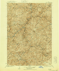
1930 Map of Casto
USGS Topo · Published 1930About this map
Mining operations and remote homesteads define this high-altitude landscape of central Idaho during the mid-1920s survey period. High peaks such as Middle Fork Peak and Sleeping Deer Mtn tower over a complex network of drainages including Pistol Creek and the Salmon River. The map meticulously records the industrial footprint of the era, from the Yellowjacket Mine in the northeast to the Lost Packer Mine and Parker Mill further south. These sites, often located at extreme elevations near Pinyon Peak, were the lifeblood of the local economy before the large-scale consolidation of national forests.
Find a feature on this map
101 named features on this map. Tap any name to fly to it.
Don’t see what you’re looking for? This feature index may not catch every label — zoom into the map to look around manually.
Map Details
Editions of this 1930 Casto Map
2 editions found
Other maps of this area

1891 · Bear Valley
USGS Topo · 1:125,000

1893 · Bear Valley
USGS Topo · 1:125,000

1919 · Custer
USGS Topo · 1:125,000

1922 · Custer
USGS Topo · 1:125,000

1929 · Bayhorse
USGS Topo · 1:125,000

1950 · Blackbird Mtn
USGS Topo · 1:62,500

1951 · Blackbird Mtn
USGS Topo · 1:62,500

1956 · Twin Peaks
USGS Topo · 1:62,500

1956 · Elk City
USGS Topo · 1:250,000

1957 · Challis
USGS Topo · 1:250,000