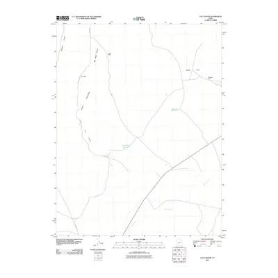
2011 Map of Cat Canyon
USGS Topo · Published 2011About this map
The Cricket Mountains define the western reaches of this Millard County landscape, providing a high-relief boundary to the broad basin of Big Sage Valley. This 2011 survey captures a remote section of the Great Basin where drainage and transport follow the natural contours of the desert terrain. To the north, Cedar Pass and Red Pass provide established crossing points through the mountain range, connecting the western canyons to the flatter valleys in the east.
Find a feature on this map
12 named features on this map. Tap any name to fly to it.
Don’t see what you’re looking for? This feature index may not catch every label — zoom into the map to look around manually.
Map Details
Editions of this 2011 Cat Canyon Map
This is the sole edition of this map. No revisions or reprints were ever made.
Other maps of this area

1885 · Beaver
USGS Topo · 1:250,000

1953 · Richfield
USGS Topo · 1:250,000

1958 · Richfield
USGS Topo · 1:250,000

1960 · Beaver Lake Mts.
USGS Topo · 1:62,500

1972 · Headlight Mtn
USGS Topo · 1:24,000
1972 · Sevier Lake NE
USGS Topo · 1:24,000

1973 · Cruz
USGS Topo · 1:24,000

1973 · Antelope Spring
USGS Topo · 1:24,000
1973 · Borden
USGS Topo · 1:24,000

1973 · Black Rock
USGS Topo · 1:24,000