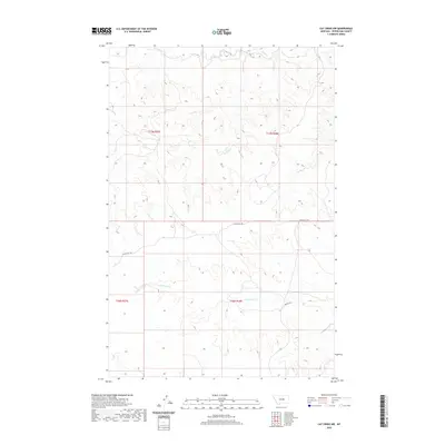
2020 Map of Cat Creek NW
USGS Topo · Published 2020About this map
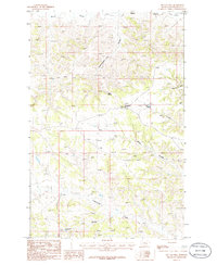
The drainage of Blood Cr dominates the northern reaches of this Petroleum County landscape, where the deeply dissected terrain of the Missouri River breaks defines the topography. The map reveals a sparsely populated ranching or grazing territory where infrastructure is limited to fundamental arterial routes like Tincan Hill Rd and Koenig Dr. These roads follow the high ground and natural contours of the land, providing access between the upland plateaus and the valley floors. To the south, the watershed of Cottonwood Cr carves its own path through the badlands, illustrating the characteristic erosional patterns of central Montana. This 2020 survey is essential for understanding the modern layout of these remote section lines and township boundaries, including T17N R27E and T16N R28E, in a region where the natural watercourse remains the primary geographical landmark.
Find a feature on this map
8 named features on this map. Tap any name to fly to it.
Don’t see what you’re looking for? This feature index may not catch every label — zoom into the map to look around manually.
Map Details
Editions of this 2020 Cat Creek NW Map
This is the sole edition of this map. No revisions or reprints were ever made.
Other maps of this area

1954 · Lewistown
USGS Topo · 1:250,000

1959 · Lewistown
USGS Topo · 1:250,000
1985 · Kirkendal Flat
USGS Topo · 1:24,000

1985 · Brown Spring
USGS Topo · 1:24,000
1985 · Davis Spring
USGS Topo · 1:24,000
1986 · Cat Creek
USGS Topo · 1:24,000

1986 · Ingals Dam
USGS Topo · 1:24,000

1986 · Winnett North
USGS Topo · 1:24,000
1986 · Tin Can Hill
USGS Topo · 1:24,000

1986 · Dry Blood Creek East
USGS Topo · 1:24,000