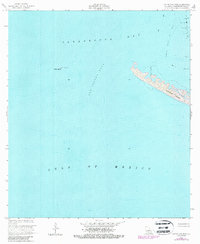
1953 Map of Cat Island Pass
USGS Topo · Published 1986About this map
Timbalier Island and Wine Island stand as vulnerable outposts against the Gulf of Mexico in this coastal survey. The map documents a volatile landscape where the barrier islands protect the inner waters of Terrebonne Bay. The presence of the Caillou Island Oil Field in the northeast and a lone Oil Well on the eastern edge of the quadrangle signify the intensive offshore petroleum activity of the mid-20th century. Navigational markers like Marker No 1, a Light, and the deep channel of Cat Island Pass itself serve as the only stationary landmarks in an environment of shifting sands and open water. This record is particularly valuable for tracking the dramatic morphological changes of the Louisiana coastline, as it incorporates revisions from 1978 and 1980 aerial photography over the original 1953 topography.
Find a feature on this map
10 named features on this map. Tap any name to fly to it.
Don’t see what you’re looking for? This feature index may not catch every label — zoom into the map to look around manually.
Map Details
Editions of this 1953 Cat Island Pass Map
4 editions found
Other maps of this area

1894 · Timbalier
USGS Topo · 1:62,500

1935 · Cocodrie
USGS Topo · 1:31,680

1935 · Timbalier Island
USGS Topo · 1:31,680
1945 · Cocodrie
USGS Topo · 1:31,680

1945 · Lake La Graisse
USGS Topo · 1:31,680

1945 · New Orleans
USGS Topo · 1:250,000

1946 · Lake La Graisse
USGS Topo · 1:31,680

1947 · Jacko Bay
USGS Topo · 1:31,680
1953 · Eastern Isles Dernieres
USGS Topo · 1:24,000
1953 · Jacko Bay
USGS Topo · 1:24,000