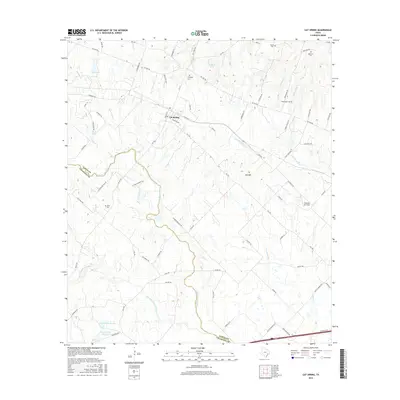
2016 Map of Cat Spring
USGS Topo · Published 2016About this map
Cat Spring serves as the focal point of this Austin County landscape, where the geography is defined by the winding course of the San Bernard River and its various tributaries. The settlement pattern is characterized by established family holdings and rural infrastructure, evidenced by numerous named cemeteries that reflect the area's genealogical depth, including Millheim Cem, Swearingen Cem, and Johse Cem. The transition from the more developed corridor near Red Hill to the wetlands of Hurvey Lake Number 1 and Hurvey Lake Number 2 highlights the area's diverse hydraulic profile.
Find a feature on this map
76 named features on this map. Tap any name to fly to it.
Don’t see what you’re looking for? This feature index may not catch every label — zoom into the map to look around manually.
Map Details
Editions of this 2016 Cat Spring Map
This is the sole edition of this map. No revisions or reprints were ever made.
Other maps of this area

1953 · Seguin
USGS Topo · 1:250,000

1956 · Bellville
USGS Topo · 1:62,500

1956 · Sealy
USGS Topo · 1:62,500

1956 · Wallis
USGS Topo · 1:62,500

1957 · Eagle Lake
USGS Topo · 1:62,500

1958 · Seguin
USGS Topo · 1:250,000

1958 · Bernardo
USGS Topo · 1:24,000

1958 · Alleyton
USGS Topo · 1:24,000
1960 · Rexville
USGS Topo · 1:24,000
1960 · Sealy
USGS Topo · 1:24,000