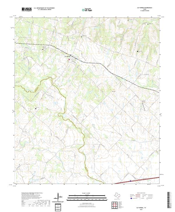
2022 Map of Cat Spring
USGS Topo · Published 2022About this map
Cat Spring serves as a focal point for this rural landscape where the San Bernard River and its various tributaries, such as the Little San Bernard River and Little Bernard Cr, carve through the terrain. The map reveals a deeply rooted community structure, evidenced by a high density of family and congregational burial sites including the Saint John Lutheran Church Cem, Millheim Cem, and Jokse Cem. These sites, alongside the Saint John Lutheran Church, point to the enduring cultural heritage of the German-Texan settlements that historically defined this part of Austin County.
Find a feature on this map
74 named features on this map. Tap any name to fly to it.
Don’t see what you’re looking for? This feature index may not catch every label — zoom into the map to look around manually.
Map Details
Editions of this 2022 Cat Spring Map
This is the sole edition of this map. No revisions or reprints were ever made.
Other maps of this area

1953 · Seguin
USGS Topo · 1:250,000

1956 · Bellville
USGS Topo · 1:62,500

1956 · Sealy
USGS Topo · 1:62,500

1956 · Wallis
USGS Topo · 1:62,500

1957 · Eagle Lake
USGS Topo · 1:62,500

1958 · Seguin
USGS Topo · 1:250,000

1958 · Bernardo
USGS Topo · 1:24,000

1958 · Alleyton
USGS Topo · 1:24,000
1960 · Rexville
USGS Topo · 1:24,000
1960 · Sealy
USGS Topo · 1:24,000