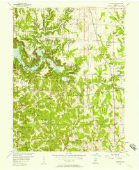
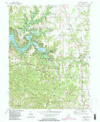
1956 Map of Cataract
USGS Topo · Published 1964About this map
Lower Cataract Falls and Upper Cataract Falls define this mid-century landscape where the Mill Creek valley meets the newly created Cataract Lake. The terrain is marked by significant topographical change, with the waters of Mill Creek flowing past the settlement of Cataract and into the reservoir near Ernie Pyle Island. This 1956 field-checked map captures the region during a period of transition as local infrastructure adapted to the lake's presence, including the Township Sch near Cunot and the Monon railroad line cutting through the eastern sections.
Find a feature on this map
39 named features on this map. Tap any name to fly to it.
Don’t see what you’re looking for? This feature index may not catch every label — zoom into the map to look around manually.
Map Details
Editions of this 1956 Cataract Map
6 editions found
Other maps of this area

1947 · Gosport
USGS Topo · 1:24,000

1949 · Quincy
USGS Topo · 1:24,000

1950 · Gosport
USGS Topo · 1:24,000

1952 · Reelsville
USGS Topo · 1:24,000

1953 · Indianapolis
USGS Topo · 1:250,000

1956 · Indianapolis
USGS Topo · 1:250,000

1956 · Cloverdale
USGS Topo · 1:24,000

1956 · Cataract
USGS Topo · 1:24,000

1956 · Eminence
USGS Topo · 1:24,000

1956 · Patricksburg
USGS Topo · 1:24,000