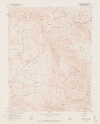
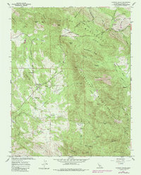
1962 Map of Catheys Valley
USGS Topo · Published 1964About this map
Catheys Valley and its surrounding foothills are documented in this 1962 survey, revealing a landscape defined by the remnants of Mariposa County's mining and ranching history. The settlement pattern is centered along the winding Hornitos Road and Mt Bullion Road, where local community life is anchored by the Catheys Valley School and Catheys Valley Cemetery. To the east, the Guadalupe Mountains rise sharply, punctuated by industrial history at the Francis Mine and several kilns. The map provides significant genealogical value by noting the exact locations of Agua Fria (Site) and Carson (Site), former community centers that had already transitioned to historical sites by the early 1960s. From the airstrip near Owens Creek to the remote Savages Trading Post in the south, the sheet captures a rural California community in a period of transition, maintaining its rugged character through landmarks like Mockingbird Ridge and Bull Run Valley.
Find a feature on this map
62 named features on this map. Tap any name to fly to it.
Don’t see what you’re looking for? This feature index may not catch every label — zoom into the map to look around manually.
Map Details
Editions of this 1962 Catheys Valley Map
5 editions found
Other maps of this area

1893 · Sonora
USGS Topo · 1:125,000

1896 · Sonora
USGS Topo · 1:125,000

1897 · Sonora
USGS Topo · 1:125,000

1897 · Yosemite
USGS Topo · 1:125,000

1898 · Sonora
USGS Topo · 1:125,000

1900 · Yosemite
USGS Topo · 1:125,000

1903 · Yosemite
USGS Topo · 1:125,000

1909 · Yosemite
USGS Topo · 1:125,000

1912 · Mariposa
USGS Topo · 1:125,000

1915 · Owens Creek
USGS Topo · 1:31,680