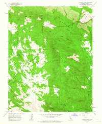
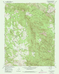
1962 Map of Catheys Valley
USGS Topo · Published 1964About this map
Catheys Valley serves as the central hub of this 1962 Mariposa County survey, situated at the base of Wildcat Mountain. The landscape is a network of ridges and canyons, where local history is anchored by the Catheys Valley Cemetery and the Catheys Valley School. To the northeast, the Agua Fria (Site) marks a significant historical location near the headwaters of Agua Fria Creek.
Find a feature on this map
61 named features on this map. Tap any name to fly to it.
Don’t see what you’re looking for? This feature index may not catch every label — zoom into the map to look around manually.
Map Details
Editions of this 1962 Catheys Valley Map
5 editions found
Other maps of this area

1893 · Sonora
USGS Topo · 1:125,000

1896 · Sonora
USGS Topo · 1:125,000

1897 · Sonora
USGS Topo · 1:125,000

1897 · Yosemite
USGS Topo · 1:125,000

1898 · Sonora
USGS Topo · 1:125,000

1900 · Yosemite
USGS Topo · 1:125,000

1903 · Yosemite
USGS Topo · 1:125,000

1909 · Yosemite
USGS Topo · 1:125,000

1912 · Mariposa
USGS Topo · 1:125,000

1915 · Owens Creek
USGS Topo · 1:31,680