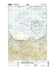
2014 Map of Cathlamet Bay
USGS Topo · Published 2014About this map
Cathlamet Bay and its complex archipelago of marshy islands dominate this coastal landscape east of Astoria. This 2014 survey reveals the intricate drainage patterns of the Columbia River estuary, where numerous channels like the Prairie Channel and Woody Island Channel weave around landmasses such as Russian Island and Grassy Island. The mainland terrain transitions from the low-lying reaches of the John Day River and Wallooskee River to the elevated ground at Fern Hill.
Find a feature on this map
69 named features on this map. Tap any name to fly to it.
Don’t see what you’re looking for? This feature index may not catch every label — zoom into the map to look around manually.
Map Details
Editions of this 2014 Cathlamet Bay Map
This is the sole edition of this map. No revisions or reprints were ever made.
Other maps of this area

1919 · Astoria
USGS Topo · 1:62,500

1938 · Fort Columbia
USGS Topo · 1:62,500

1939 · Astoria
USGS Topo · 1:62,500

1940 · Svensen
USGS Topo · 1:62,500

1940 · Brookfield
USGS Topo · 1:62,500

1943 · Fort Columbia
USGS Topo · 1:62,500

1949 · Astoria
USGS Topo · 1:24,000

1949 · Knappton
USGS Topo · 1:24,000

1949 · Cathlamet Bay
USGS Topo · 1:24,000

1949 · Green Mountain
USGS Topo · 1:24,000