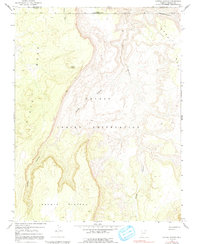
1970 Map of Cattle Canyon
USGS Topo · Published 1991About this map
Fullers Spring marks a vital water point in this high-altitude landscape where the Utah-Arizona border crosses through the Navajo Indian Reservation. This 1970 survey illustrates the dramatic geological transition from the massive Piute Mesa in the west to the deep incisions of Nokai Canyon in the east. The terrain is defined by extreme vertical relief, where the Shonto Plateau drops away into the namesake Cattle Canyon and the winding Neskahi Wash.
Find a feature on this map
11 named features on this map. Tap any name to fly to it.
Don’t see what you’re looking for? This feature index may not catch every label — zoom into the map to look around manually.
Map Details
Editions of this 1970 Cattle Canyon Map
4 editions found
Other maps of this area

1883 · Marsh Pass
USGS Topo · 1:250,000

1886 · Henry Mountains
USGS Topo · 1:250,000

1892 · Marsh Pass
USGS Topo · 1:250,000

1892 · Henry Mountains
USGS Topo · 1:250,000

1952 · Shato Spring 1 NE
USGS Topo · 1:24,000

1952 · Agathla Peak 2 SW
USGS Topo · 1:24,000

1952 · Agathla Peak 2 NW
USGS Topo · 1:24,000

1952 · Boot Mesa
USGS Topo · 1:62,500

1952 · Clay Hills 3 SW
USGS Topo · 1:24,000

1952 · Navajo Mtn. 4 SE
USGS Topo · 1:24,000