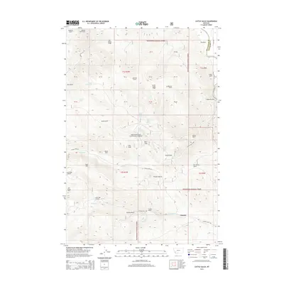
2014 Map of Cattle Gulch
USGS Topo · Published 2014About this map
Beaverhead National Forest land dominates this high-country landscape along the border of Beaverhead and Silver Bow counties. The settlement of Glendale sits at the southern edge of the map, situated near the junction of Trapper Cr and Sucker Cr. This area is defined by a dense network of gulches and ridges that speak to early resource extraction and timber work, evidenced by names like Sawmill Gulch, Limekiln Gulch, and Quartz Hill Gulch. Water resources are central to the terrain, from the Big Hole River in the northeast corner to alpine features such as Cattle Gulch Lake and Trusty Lake. Significant topographical landmarks including Nez Perce Ridge and Ore Camp Hill provide a clear view of the mountain geography before the forest descends toward Sage Flat and Picketts Pasture.
Find a feature on this map
54 named features on this map. Tap any name to fly to it.
Don’t see what you’re looking for? This feature index may not catch every label — zoom into the map to look around manually.
Map Details
Editions of this 2014 Cattle Gulch Map
This is the sole edition of this map. No revisions or reprints were ever made.
Other maps of this area

1893 · Dillon
USGS Topo · 1:250,000

1955 · Dillon
USGS Topo · 1:250,000

1957 · Dillon
USGS Topo · 1:250,000

1958 · Dillon
USGS Topo · 1:250,000

1958 · Vipond Park
USGS Topo · 1:62,500

1961 · Melrose
USGS Topo · 1:24,000

1961 · Earls Gulch
USGS Topo · 1:24,000

1961 · Butte South
USGS Topo · 1:62,500

1961 · Dewey
USGS Topo · 1:24,000

1961 · Wise River
USGS Topo · 1:24,000