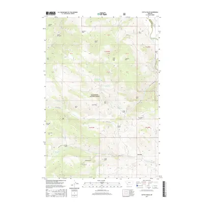
2017 Map of Cattle Gulch
USGS Topo · Published 2017About this map
Beaverhead National Forest land dominates this high-altitude landscape, where deep drainages like Cattle Gulch and Limekiln Gulch carve into the mountainous terrain along the boundary of Silver Bow and Beaverhead counties. In the southeast corner, the settlement of Glendale sits at the base of the foothills near Trapper Cr, representing a pocket of development amidst more isolated features such as Picketts Pasture and Ore Camp Hill. The hydrography of the region is defined by the Big Hole River in the northeast and a series of springs including Upper Cattle Gulch Spring and Lower Cattle Gulch Spring. The naming conventions found here, such as Quartz Hill Gulch and Sawmill Gulch, hint at the historical extractive industries that once supported local populations in these remote gulches.
Find a feature on this map
57 named features on this map. Tap any name to fly to it.
Don’t see what you’re looking for? This feature index may not catch every label — zoom into the map to look around manually.
Map Details
Editions of this 2017 Cattle Gulch Map
This is the sole edition of this map. No revisions or reprints were ever made.
Other maps of this area

1893 · Dillon
USGS Topo · 1:250,000

1955 · Dillon
USGS Topo · 1:250,000

1957 · Dillon
USGS Topo · 1:250,000

1958 · Dillon
USGS Topo · 1:250,000

1958 · Vipond Park
USGS Topo · 1:62,500

1961 · Melrose
USGS Topo · 1:24,000

1961 · Earls Gulch
USGS Topo · 1:24,000

1961 · Butte South
USGS Topo · 1:62,500

1961 · Dewey
USGS Topo · 1:24,000

1961 · Wise River
USGS Topo · 1:24,000