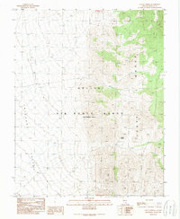
1989 Map of Cattle Spring
USGS Topo · Published 1989About this map
Nellis Air Force Range (Restricted Area) dominates this Lincoln County terrain, where high-desert military airspace meets the isolated topography of the Great Basin. This 1989 provisional study documents a landscape defined by sharp elevation shifts between the flat expanse of Emigrant Valley to the west and the rising peaks of the Groom Range to the east. A single Mine Shaft and the namesake Cattle Spring represent the few physical landmarks in this high-security zone, illustrating the historical intersection of early prospecting and grazing with modern restricted defense operations. The map provides a precise view of the township and range lines, such as R 55 E T 5 S, marking the remote interior of the Nevada desert during the late Cold War era.
Find a feature on this map
7 named features on this map. Tap any name to fly to it.
Don’t see what you’re looking for? This feature index may not catch every label — zoom into the map to look around manually.
Map Details
Editions of this 1989 Cattle Spring Map
This is the sole edition of this map. No revisions or reprints were ever made.
Other maps of this area

1942 · Emigrant Valley
USGS Topo · 1:125,000

1942 · Penoyer Valley
USGS Topo · 1:125,000

1952 · White Blotch Springs
USGS Topo · 1:62,500

1952 · Groom Mine
USGS Topo · 1:62,500

1954 · Caliente
USGS Topo · 1:250,000

1959 · Caliente
USGS Topo · 1:250,000
1962 · Groom Mine SW
USGS Topo · 1:24,000

1964 · Tempiute Mtn
USGS Topo · 1:62,500

1985 · Pahranagat Range
USGS Topo · 1:100,000
1987 · Tempiute Mountain South
USGS Topo · 1:24,000