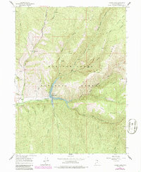
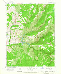
1964 Map of Causey Dam
USGS Topo · Published 1986About this map
Causey Reservoir forms the heart of this landscape, created by the Causey Dam at the confluence of several mountain drainages. The map illustrates a high-elevation backcountry within the Wasatch Cache National Forest, where the South Fork Ogden River meets tributaries like Skull Crack and Beaver Creek. Human presence is concentrated in the western canyons, featuring Red Rock Ranch, Camp Red Cliff, and County Memorial Park.
Find a feature on this map
82 named features on this map. Tap any name to fly to it.
Don’t see what you’re looking for? This feature index may not catch every label — zoom into the map to look around manually.
Map Details
Editions of this 1964 Causey Dam Map
3 editions found
Other maps of this area

1954 · Ogden
USGS Topo · 1:250,000

1958 · Ogden
USGS Topo · 1:250,000

1960 · Ogden
USGS Topo · 1:250,000

1961 · Morgan
USGS Topo · 1:62,500

1964 · Lost Creek Dam
USGS Topo · 1:24,000

1964 · Monte Cristo PK
USGS Topo · 1:24,000
1964 · Sharp Mountain
USGS Topo · 1:24,000
1964 · Browns Hole
USGS Topo · 1:24,000
1964 · Causey Dam
USGS Topo · 1:24,000

1968 · Horse Ridge
USGS Topo · 1:24,000