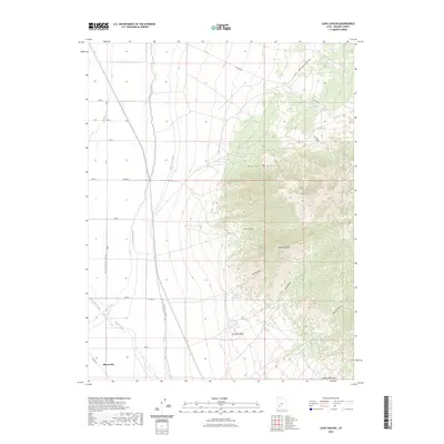
2023 Map of Cave Canyon
USGS Topo · Published 2023About this map
The Mineral Mountains dominate the eastern landscape of this quadrangle, giving way to the irrigated agricultural lands of the Escalante Desert to the west. This territory at the edge of the Beaver River valley shows a sophisticated water management system vital to local ranching and farming, featuring the Low Line Canal, High Line Canal, and the Imperial Avenue Canal. These human-made waterways parallel the base of the mountains, tracing the boundary between the steep canyons of the range and the valley floor where the settlement of Minersville is situated.
Find a feature on this map
25 named features on this map. Tap any name to fly to it.
Don’t see what you’re looking for? This feature index may not catch every label — zoom into the map to look around manually.
Map Details
Editions of this 2023 Cave Canyon Map
This is the sole edition of this map. No revisions or reprints were ever made.
Other maps of this area

1885 · Beaver
USGS Topo · 1:250,000

1953 · Ninemile Knoll
USGS Topo · 1:24,000

1953 · Milford Flat
USGS Topo · 1:24,000

1953 · Minersville
USGS Topo · 1:24,000

1953 · Cave Canyon
USGS Topo · 1:24,000

1953 · Richfield
USGS Topo · 1:250,000

1958 · Richfield
USGS Topo · 1:250,000

1958 · Minersville
USGS Topo · 1:62,500

1958 · Thermo
USGS Topo · 1:62,500

1958 · Milford
USGS Topo · 1:62,500