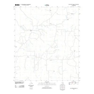
2010 Map of Cave Creek School
USGS Topo · Published 2010About this map
The family-held ranchlands and creek beds of Gillespie County characterize this survey of the Texas Hill Country. Named family holdings like the Koennecke Ranch, Ahrens Ranch, and Smith Ranch are scattered throughout the landscape, reflecting a pattern of long-standing agricultural and pastoral use. The terrain is marked by significant rises such as Kruse Hill and the distinctive Roundhead, while an intricate drainage network including North Grape Creek, Dry Hollow Creek, and Cave Creek carves through the limestone-influenced topography. For genealogists and local researchers, the presence of the Youngs Chapel Cemetery and Rode Cemetery identifies important community focal points and burial sites for many of the area's founding families, preserving their locations in the modern era.
Find a feature on this map
17 named features on this map. Tap any name to fly to it.
Don’t see what you’re looking for? This feature index may not catch every label — zoom into the map to look around manually.
Map Details
Editions of this 2010 Cave Creek School Map
This is the sole edition of this map. No revisions or reprints were ever made.
Other maps of this area

1894 · Fredericksburg
USGS Topo · 1:125,000

1954 · Llano
USGS Topo · 1:250,000

1955 · Llano
USGS Topo · 1:250,000

1956 · Llano
USGS Topo · 1:250,000

1961 · Stonewall
USGS Topo · 1:24,000

1961 · Hye
USGS Topo · 1:24,000

1961 · Cave Creek School
USGS Topo · 1:24,000

1961 · Rocky Creek
USGS Topo · 1:24,000

1963 · Cain City
USGS Topo · 1:24,000

1967 · Fredericksburg East
USGS Topo · 1:24,000