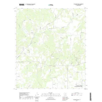
2019 Map of Cave Creek School
USGS Topo · Published 2019About this map
Cave Creek School stands as a focal point for this rural stretch of Gillespie County, serving a landscape of winding cattle roads and creek bottoms. The terrain is deeply carved by water, with the forks of North Grape Creek and Dry Hollow Cr defining the northern reaches of the sheet. Modern ranching and residential life are evident in the developments at Hidden Acres and Heiner James, while the southern margin captures a portion of the Lyndon B. Johnson National Historical Park. The road network is heavily influenced by the drainage patterns of Cave Cr, where historical family-named routes like Rheingold School Rd and Koennecke-Eckhardt Rd reflect the enduring legacy of early German settlement in the Texas Hill Country. Genealogists may find value in the specific locations of Rode Cem and Youngs Chapel Cem, which remain tucked away near the headwaters of the local creek systems.
Find a feature on this map
56 named features on this map. Tap any name to fly to it.
Don’t see what you’re looking for? This feature index may not catch every label — zoom into the map to look around manually.
Map Details
Editions of this 2019 Cave Creek School Map
This is the sole edition of this map. No revisions or reprints were ever made.
Other maps of this area

1894 · Fredericksburg
USGS Topo · 1:125,000

1954 · Llano
USGS Topo · 1:250,000

1955 · Llano
USGS Topo · 1:250,000

1956 · Llano
USGS Topo · 1:250,000

1961 · Stonewall
USGS Topo · 1:24,000

1961 · Hye
USGS Topo · 1:24,000

1961 · Cave Creek School
USGS Topo · 1:24,000

1961 · Rocky Creek
USGS Topo · 1:24,000

1963 · Cain City
USGS Topo · 1:24,000

1967 · Fredericksburg East
USGS Topo · 1:24,000