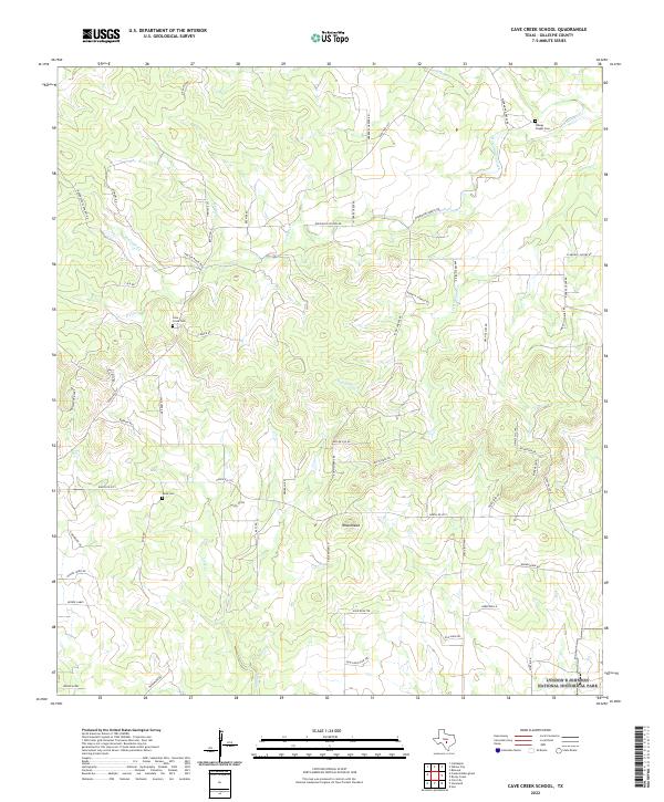
2022 Map of Cave Creek School
USGS Topo · Published 2022About this map
The Hill Country of Gillespie County is defined here by a network of ranch roads and limestone-bedded waterways, including North Grape Creek and Dry Hollow Cr. The landscape is largely agricultural, marked by family-named routes such as Wahrmund Ahrens Rd and Klein-Ahrens Rd, which trace the legacy of early German-Texas settlement patterns in the region.
Find a feature on this map
59 named features on this map. Tap any name to fly to it.
Don’t see what you’re looking for? This feature index may not catch every label — zoom into the map to look around manually.
Map Details
Editions of this 2022 Cave Creek School Map
This is the sole edition of this map. No revisions or reprints were ever made.
Other maps of this area

1894 · Fredericksburg
USGS Topo · 1:125,000

1954 · Llano
USGS Topo · 1:250,000

1955 · Llano
USGS Topo · 1:250,000

1956 · Llano
USGS Topo · 1:250,000

1961 · Stonewall
USGS Topo · 1:24,000

1961 · Hye
USGS Topo · 1:24,000

1961 · Cave Creek School
USGS Topo · 1:24,000

1961 · Rocky Creek
USGS Topo · 1:24,000

1963 · Cain City
USGS Topo · 1:24,000

1967 · Fredericksburg East
USGS Topo · 1:24,000