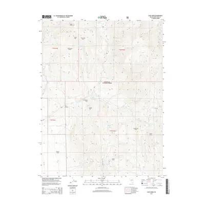
2014 Map of Cave Creek
USGS Topo · Published 2014About this map
Humboldt National Forest encompasses the high-altitude terrain of the Schell Creek Range and Duck Creek Range in this Nevada survey. The hydrology of the area is defined by numerous high-desert springs, including Mosier Spring and Cave Creek Spring, which feed into drainage systems like Steptoe Cr. At The Narrows, the landscape transitions toward the broader Steptoe Valley, where the Cave Creek Reservoir serves as a critical water management feature. Topographical landmarks such as Camel Peak, Square Top, and Cooper Summit offer clear orientation points across the complex system of canyons, notably Mosier Canyon and Grasshopper Canyon. The map records a modern forest infrastructure, including Cooper Wash Rd and NFD 574 Rd, supporting access through these protected lands.
Find a feature on this map
36 named features on this map. Tap any name to fly to it.
Don’t see what you’re looking for? This feature index may not catch every label — zoom into the map to look around manually.
Map Details
Editions of this 2014 Cave Creek Map
This is the sole edition of this map. No revisions or reprints were ever made.
Other maps of this area

1952 · Ely
USGS Topo · 1:125,000

1956 · Ely
USGS Topo · 1:250,000

1958 · East Ely
USGS Topo · 1:24,000

1958 · Comins Lake
USGS Topo · 1:24,000

1958 · Ely
USGS Topo · 1:62,500

1958 · McGill
USGS Topo · 1:62,500

1959 · Ely
USGS Topo · 1:250,000

1959 · Connors Pass
USGS Topo · 1:62,500

1959 · Schell Peaks
USGS Topo · 1:62,500

1963 · Ely
USGS Topo · 1:250,000