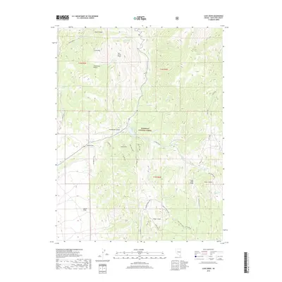
2018 Map of Cave Creek
USGS Topo · Published 2018About this map
Humboldt National Forest encompasses this high-altitude landscape where the Schell Creek Range and Duck Creek Range converge. The topography is defined by significant drainage systems, including Steptoe Creek and its tributary South Fork Steptoe Creek, which feed into the Cave Creek Reservoir. This map documents a complex network of canyons such as Mosier Canyon, Tamberlaine Canyon, and Cooper Canyon, illustrating the natural water sources vital to the region like Mosier Spring and Cave Creek Spring. For those interested in the historical movement through these peaks, the map details established paths like The Narrows Trail and the Summit Spring Trail, alongside distinctive summits including Camel Peak and Square Top. The transition from the high ridges down to the Steptoe Valley on the western edge highlights the stark elevation changes typical of this Nevada wilderness.
Find a feature on this map
41 named features on this map. Tap any name to fly to it.
Don’t see what you’re looking for? This feature index may not catch every label — zoom into the map to look around manually.
Map Details
Editions of this 2018 Cave Creek Map
This is the sole edition of this map. No revisions or reprints were ever made.
Other maps of this area

1952 · Ely
USGS Topo · 1:125,000

1956 · Ely
USGS Topo · 1:250,000

1958 · East Ely
USGS Topo · 1:24,000

1958 · Comins Lake
USGS Topo · 1:24,000

1958 · Ely
USGS Topo · 1:62,500

1958 · McGill
USGS Topo · 1:62,500

1959 · Ely
USGS Topo · 1:250,000

1959 · Connors Pass
USGS Topo · 1:62,500

1959 · Schell Peaks
USGS Topo · 1:62,500

1963 · Ely
USGS Topo · 1:250,000