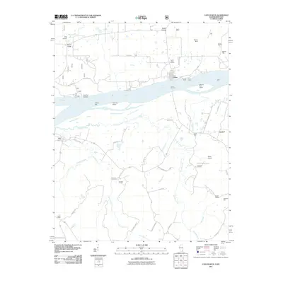
2011 Map of Cave-in-Rock
USGS Topo · Published 2011About this map
Cave-In-Rock serves as a central hub on the Illinois side of the Ohio River, where the Cave In Rock Ferry maintains a traditional river crossing to the Kentucky shore. The landscape is defined by the river's influence, featuring notable landforms like Cave In Rock Island, Walker Bar, and McKinley Island. In the surrounding countryside of Hardin County and across the water in Kentucky, a network of rural life is evident through numerous family and community landmarks. Researchers can trace historical sites such as Peters Creek Cemetery, Dunn Spring Cemetery, and Underdown Cemetery. Local industry is represented by the Alco Mine, Spring Mine, and Rigsby Quarry, while recreational spaces like the Tower Rock Camp and Picnic Area utilize the river's edge. The southern portion of the sheet reveals the smaller settlements of Tolu and Irma along a system of creek-fed valleys including Hurricane Creek and Caney Fork.
Find a feature on this map
59 named features on this map. Tap any name to fly to it.
Don’t see what you’re looking for? This feature index may not catch every label — zoom into the map to look around manually.
Map Details
Editions of this 2011 Cave-in-Rock Map
This is the sole edition of this map. No revisions or reprints were ever made.
Other maps of this area

1916 · Shawneetown
USGS Topo · 1:62,500

1916 · Fords Ferry
USGS Topo · 1:62,500

1916 · Golconda
USGS Topo · 1:62,500

1916 · Equality
USGS Topo · 1:62,500

1920 · Goloonda
USGS Topo · 1:48,000

1921 · Fords Ferry
USGS Topo · 1:48,000

1921 · Golconda
USGS Topo · 1:62,500

1925 · Cave In Rock
USGS Topo · 1:62,500

1949 · Paducah
USGS Topo · 1:250,000

1950 · Paducah
USGS Topo · 1:250,000