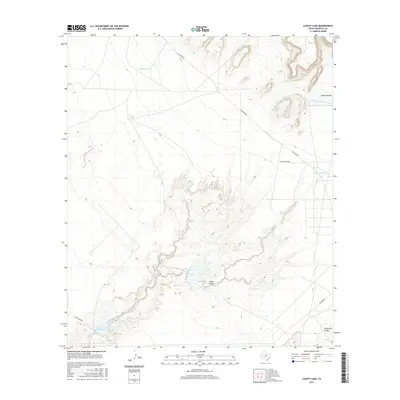
2016 Map of Cavett Lake
USGS Topo · Published 2016About this map
Alamo Arroyo and Camp Rice Arroyo wind through this arid Hudspeth County landscape, defining the drainage patterns of the Trans-Pecos region. The terrain is characterized by a series of water management features essential for ranching and conservation in this dry climate, including Phillip Tank, Caliche Tank, and Alamo Reservoir Number One. A larger catchment area is found at Cavett Lake, while the Soil Conservation Service Site 3 Reservoir indicates mid-20th-century federal efforts to manage runoff and prevent erosion. Remote transit in the area is facilitated by Mcguyers Roads and Mcguire Rd, which connect these isolated water sources and canyon lands. The geography reflects a sparse, utilitarian land use focused on water collection, centered around the prominent Alamo Canyon.
Find a feature on this map
13 named features on this map. Tap any name to fly to it.
Don’t see what you’re looking for? This feature index may not catch every label — zoom into the map to look around manually.
Map Details
Editions of this 2016 Cavett Lake Map
This is the sole edition of this map. No revisions or reprints were ever made.
Other maps of this area

1894 · Fort Hancock
USGS Topo · 1:125,000

1903 · Cerro Alto
USGS Topo · 1:125,000

1942 · Borrego
USGS Topo · 1:62,500

1943 · Tepee Butte
USGS Topo · 1:62,500

1943 · Finlay Mountains
USGS Topo · 1:62,500

1943 · Fort Hancock
USGS Topo · 1:62,500

1954 · Van Horn
USGS Topo · 1:250,000

1958 · Van Horn
USGS Topo · 1:250,000
1972 · Campo Grande Mountain
USGS Topo · 1:24,000
1972 · Fort Hancock NW
USGS Topo · 1:24,000