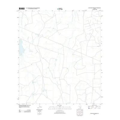
2012 Map of Cayetano Creek
USGS Topo · Published 2012About this map
Farias family ranching interests define the landscape of this corner of Maverick County, marked by a series of numbered reservoirs and catchment basins. The drainage network is anchored by Pendencia Cr and Cayetano Cr, which wind through the arid terrain alongside smaller tributaries like Comanche Cr and Rocky Cr. These water sources were vital for sustaining livestock and agricultural operations in a region where surface water is seasonal and scarce. The map reveals a sparse infrastructure typical of South Texas rangeland, where private access roads and the singular Co RD 173 provide the only passage through large landholdings. Notable water features include Farias Ranch Lake Number 2, Farias Ranch Lake Number 3, and Farias Lake, reflecting a systematic approach to water management on the expansive ranch estates during the early 21st century.
Find a feature on this map
11 named features on this map. Tap any name to fly to it.
Don’t see what you’re looking for? This feature index may not catch every label — zoom into the map to look around manually.
Map Details
Editions of this 2012 Cayetano Creek Map
This is the sole edition of this map. No revisions or reprints were ever made.
Other maps of this area

1929 · Cotulla
USGS Topo · 1:125,000

1939 · Carrizo Springs
USGS Topo · 1:62,500

1940 · Asherton
USGS Topo · 1:62,500

1940 · Cometa
USGS Topo · 1:62,500

1941 · Botella Creek
USGS Topo · 1:62,500

1953 · Crystal City
USGS Topo · 1:250,000

1955 · Crystal City
USGS Topo · 1:250,000

1957 · Botella Creek
USGS Topo · 1:62,500

1958 · Eagle Pass
USGS Topo · 1:250,000

1961 · Crystal City
USGS Topo · 1:250,000