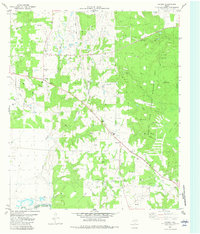
1982 Map of Cayuga
USGS Topo · Published 1982About this map
The Cayuga Oil Field dominates this early 1980s landscape at the boundary of Anderson and Freestone Counties. The industrial footprint is evident through numerous Oil Wells, Gas Wells, and a network of Pipelines that cut across the local topography. This energy infrastructure coexists with established rural landmarks such as Cayuga Sch and several country churches, including Judson Ch and New Bethel Ch.
Find a feature on this map
39 named features on this map. Tap any name to fly to it.
Don’t see what you’re looking for? This feature index may not catch every label — zoom into the map to look around manually.
Map Details
Editions of this 1982 Cayuga Map
This is the sole edition of this map. No revisions or reprints were ever made.
Other maps of this area

1949 · Athens
USGS Topo · 1:62,500

1949 · Tennessee Colony
USGS Topo · 1:62,500

1950 · Athens
USGS Topo · 1:62,500

1950 · Tennessee Colony
USGS Topo · 1:62,500

1953 · Palestine
USGS Topo · 1:250,000

1954 · Dallas
USGS Topo · 1:250,000

1954 · Waco
USGS Topo · 1:250,000

1955 · Waco
USGS Topo · 1:250,000

1956 · Tyler
USGS Topo · 1:250,000

1957 · Palestine
USGS Topo · 1:250,000