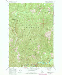
1966 Map of Cayuse Junction
USGS Topo · Published 1984About this map
The Lolo Trail traverses the high ridges of the Clearwater National Forest in this mid-1960s topographic record. This area, straddling the boundary of Clearwater Co and Idaho Co, is defined by its network of historic routes and river valleys. The southern portion of the map follows the course of the Lochsa River and the Middle Fork Lochsa River, where the Wild and Scenic River Trail passes landmarks like the Whitehouse Campground and Whitehouse Pond.
Find a feature on this map
39 named features on this map. Tap any name to fly to it.
Don’t see what you’re looking for? This feature index may not catch every label — zoom into the map to look around manually.
Map Details
Editions of this 1966 Cayuse Junction Map
2 editions found
Other maps of this area

1911 · Lolo
USGS Topo · 1:250,000

1913 · Lolo
USGS Topo · 1:250,000

1956 · Hamilton
USGS Topo · 1:250,000

1959 · Hamilton
USGS Topo · 1:250,000

1960 · Hamilton
USGS Topo · 1:250,000

1964 · Hamilton
USGS Topo · 1:250,000

1964 · Rocky Point
USGS Topo · 1:24,000
1964 · Granite Pass
USGS Topo · 1:24,000

1966 · Grave Peak
USGS Topo · 1:24,000
1966 · Rhodes Peak
USGS Topo · 1:24,000