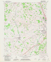
1967 Map of Cecilia
USGS Topo · Published 1980About this map
Illinois Central and Louisville and Nashville rail lines converge near Cecilia in this late-1960s landscape, illustrating the importance of rail connectivity in Hardin County. The area surrounding Elizabethtown shows significant institutional and community growth, with several educational and religious centers including Vocational Sch, Community College, and College Heights Ch appearing on the map. The rural periphery is defined by a network of creeks like Billy Creek and Rhodes Creek that carve through the limestone terrain of West Valley.
Find a feature on this map
35 named features on this map. Tap any name to fly to it.
Don’t see what you’re looking for? This feature index may not catch every label — zoom into the map to look around manually.
Map Details
Editions of this 1967 Cecilia Map
4 editions found
Other maps of this area

1932 · Big Clifty
USGS Topo · 1:62,500

1935 · Elizabethtown
USGS Topo · 1:48,000

1936 · Vine Grove
USGS Topo · 1:62,500

1938 · Elizabethtown
USGS Topo · 1:62,500

1941 · Ekron
USGS Topo · 1:62,500

1943 · Vine Grove
USGS Topo · 1:62,500

1946 · Colesburg
USGS Topo · 1:24,000

1946 · Vine Grove
USGS Topo · 1:24,000

1946 · Vine Grove
USGS Topo · 1:62,500

1947 · Ekron
USGS Topo · 1:62,500