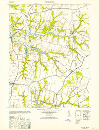
1953 Map of Cecilton
USGS Topo · Published 1953About this map
Cecilton and the surrounding agricultural necks of the Upper Eastern Shore are documented here during the mid-1940s. The landscape is defined by the deep tidal reaches of the Bohemia River and Sassafras River, which carve the territory into Middle Neck and Sassafras Neck. This survey reveals a deeply rooted rural infrastructure of country churches, including St Francis Xavier Church and Bohemia Manor Church, and local educational centers like the George Biddle HS. The map captures the interface between land and water at points like Budd Landing and Greenbrier Pt. A significant portion of the sheet tracks the Maryland and Delaware state line, marked by several specific stone monuments such as MD-DEL Boundary Mon 3. These border markers and family-named landmarks like Manlove provide exceptional detail for those tracing the historical geography of Cecil County.
Find a feature on this map
48 named features on this map. Tap any name to fly to it.
Don’t see what you’re looking for? This feature index may not catch every label — zoom into the map to look around manually.
Map Details
Editions of this 1953 Cecilton Map
2 editions found
Other maps of this area

1898 · Elkton
USGS Topo · 1:62,500

1899 · Dover
USGS Topo · 1:125,000

1900 · Elkton
USGS Topo · 1:62,500

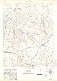
1900 · Cecilton
USGS Topo · 1:62,500

1904 · Wilmington
USGS Topo · 1:62,500

1906 · Dover
USGS Topo · 1:125,000

1906 · Wilmington
USGS Topo · 1:62,500

1917 · Elkton
USGS Topo · 1:62,500

1919 · Wilmington
USGS Topo · 1:62,500

1920 · Dover
USGS Topo · 1:125,000