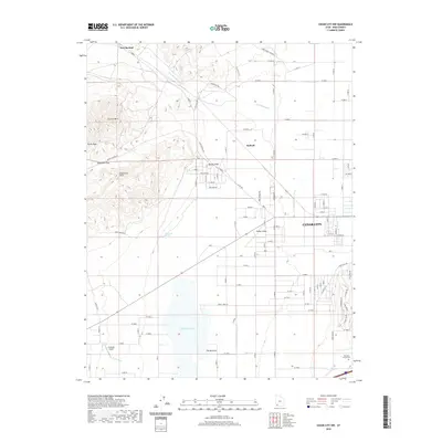
2020 Map of Cedar City NW
USGS Topo · Published 2020About this map
Cedar City expands across the eastern foothills of the Cedar Valley in this contemporary survey of Iron County. The landscape is defined by the sharp transition from the residential street grids of the city to the prominent volcanic and sedimentary formations of the west, including Granite Mtn and Swett Peak. To the south, the seasonally variable Quichapa Lake sits within a broad basin known as The Bottoms, fed by drainages like Shirts Cr and Duncan Cr. Local history is anchored by the Hamilton Family Cem and the small settlement at Iron Springs, where the creek passes through the northern hills. The map also documents modern aviation infrastructure at the Citabriair Airport, situated on the western edge of the valley floor away from the primary urban center.
Find a feature on this map
65 named features on this map. Tap any name to fly to it.
Don’t see what you’re looking for? This feature index may not catch every label — zoom into the map to look around manually.
Map Details
Editions of this 2020 Cedar City NW Map
This is the sole edition of this map. No revisions or reprints were ever made.
Other maps of this area

1885 · St. George
USGS Topo · 1:250,000

1891 · St. George
USGS Topo · 1:250,000

1949 · Cedar City NW
USGS Topo · 1:24,000

1950 · Cedar City NW
USGS Topo · 1:24,000

1950 · Kanarraville
USGS Topo · 1:24,000

1950 · Enoch
USGS Topo · 1:24,000

1950 · Cedar City
USGS Topo · 1:24,000

1950 · Enoch
USGS Topo · 1:62,500

1950 · Iron Mountain
USGS Topo · 1:62,500

1950 · Cedar City
USGS Topo · 1:62,500