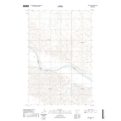
2020 Map of Cedar Coulee
USGS Topo · Published 2020About this map
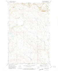
The Missouri River carves a deep path through this portion of Roosevelt County, defining the boundary with Richland County to the south. This landscape is characterized by a complex network of dry washes and ravines, including the named drainage systems of Cedar Coulee, Wells Coulee, and Star Coulee. These features emphasize the dramatic erosion of the northern plains, where flat uplands drop sharply toward the river valley. The map reveals a sparsely populated region primarily accessed by rural routes such as RD 1012 and Co RD 342, while Harmon Reservoir provides a critical water source in the northeastern corner. Topographical details like Rocky Point Coulee and Coal Coulee suggest a history of local geographic naming tied to specific terrain landmarks and potential early resource identification.
Find a feature on this map
17 named features on this map. Tap any name to fly to it.
Don’t see what you’re looking for? This feature index may not catch every label — zoom into the map to look around manually.
Map Details
Editions of this 2020 Cedar Coulee Map
This is the sole edition of this map. No revisions or reprints were ever made.
Other maps of this area

1909 · Glendive
USGS Topo · 1:250,000

1954 · Glendive
USGS Topo · 1:250,000

1954 · Wolf Point
USGS Topo · 1:250,000

1957 · Glendive
USGS Topo · 1:250,000

1958 · Wolf Point
USGS Topo · 1:250,000

1958 · Glendive
USGS Topo · 1:250,000
1969 · Cedar Coulee
USGS Topo · 1:24,000
1969 · Three Buttes
USGS Topo · 1:24,000
1969 · Bainville SW
USGS Topo · 1:24,000
1972 · Fairview NW
USGS Topo · 1:24,000