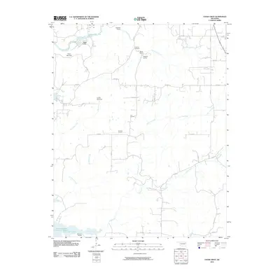
2010 Map of Cedar Crest
USGS Topo · Published 2010About this map
Cedar Crest sits in a landscape defined by an intricate network of narrow valleys and ridges, where numerous hollows like Coleman Hollow and Hogskin Hollow drain into a complex system of waterways. This 2010 survey illustrates the rugged geography of eastern Oklahoma, dominated by the northern reaches of Fort Gibson Lake and the Fitzgerald-Soldier Creek Site 1 Reservoir at the southern edge. The settlement pattern is largely rural, with homes scattered along unpaved routes such as E0640 Rd and W 680 Rd. Local history is preserved at the Gray Cemetery and Downing Cemetery, while landmarks like Neely Mountain and Hadley Mountain provide significant relief above the winding paths of Spring Creek and Little Clear Creek. This edition captures the region's character as a mix of forested terrain and water management, reflecting the enduring rural infrastructure of Mayes County.
Find a feature on this map
32 named features on this map. Tap any name to fly to it.
Don’t see what you’re looking for? This feature index may not catch every label — zoom into the map to look around manually.
Map Details
Editions of this 2010 Cedar Crest Map
This is the sole edition of this map. No revisions or reprints were ever made.
Other maps of this area

1896 · Pryor
USGS Topo · 1:125,000

1901 · Muscogee
USGS Topo · 1:125,000

1901 · Pryor
USGS Topo · 1:125,000

1905 · Muscogee
USGS Topo · 1:125,000

1946 · Fort Smith
USGS Topo · 1:250,000

1948 · Hulbert
USGS Topo · 1:62,500

1948 · Wagoner
USGS Topo · 1:62,500

1950 · Wagoner
USGS Topo · 1:62,500

1950 · Hulbert
USGS Topo · 1:62,500

1954 · Tulsa
USGS Topo · 1:250,000