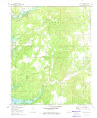
1972 Map of Cedar Crest
USGS Topo · Published 1974About this map
Fort Gibson Lake dominates the western edge of this landscape, its shoreline defining the borders between Mayes, Wagoner, and Cherokee counties. The settlement of Cedar Crest sits near the northern reaches of the water, supported by infrastructure like the Cedar Crest Lake and nearby Water Tanks. The terrain is deeply carved by a series of hollows, including Coleman Hollow, Pipe Hollow, and Hogskin Hollow, which drain from the heights of Neely Mountain and Hadley Mountain toward the basin.
Find a feature on this map
41 named features on this map. Tap any name to fly to it.
Don’t see what you’re looking for? This feature index may not catch every label — zoom into the map to look around manually.
Map Details
Editions of this 1972 Cedar Crest Map
This is the sole edition of this map. No revisions or reprints were ever made.
Other maps of this area

1896 · Pryor
USGS Topo · 1:125,000

1901 · Muscogee
USGS Topo · 1:125,000

1901 · Pryor
USGS Topo · 1:125,000

1905 · Muscogee
USGS Topo · 1:125,000

1946 · Fort Smith
USGS Topo · 1:250,000

1948 · Hulbert
USGS Topo · 1:62,500

1948 · Wagoner
USGS Topo · 1:62,500

1950 · Wagoner
USGS Topo · 1:62,500

1950 · Hulbert
USGS Topo · 1:62,500

1954 · Tulsa
USGS Topo · 1:250,000