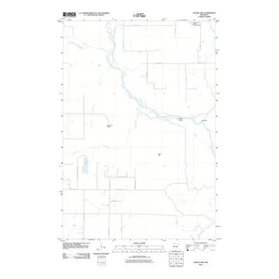
2010 Map of Cedar Lake
USGS Topo · Published 2010About this map
The Kettle River defines the landscape as it winds through this portion of Pine County, forming distinct riverine features like Maple Island and Blueberry Island. To the south, Cedar Lake sits amidst a network of rural roads that indicate modern residential development and land management, such as Blue Heron Rd and Sandhill Crane Ln. The presence of the Calvin Harth Wildlife Structure Dam in the northeast corner, near Bear Creek, highlights a focus on habitat conservation within the township. Rising above the lowlands, Bear Hill provides a subtle topographic contrast to the surrounding creeks and wetlands. This area represents a typical northern Minnesota transition between active wildlife management zones and growing rural settlements, connected by arterial routes like County Hwy-10 and County Hwy-19.
Find a feature on this map
28 named features on this map. Tap any name to fly to it.
Don’t see what you’re looking for? This feature index may not catch every label — zoom into the map to look around manually.
Map Details
Editions of this 2010 Cedar Lake Map
This is the sole edition of this map. No revisions or reprints were ever made.
Other maps of this area

1950 · Grantsburg
USGS Topo · 1:48,000

1953 · Duluth
USGS Topo · 1:250,000

1953 · Stillwater
USGS Topo · 1:250,000

1955 · Stillwater
USGS Topo · 1:250,000

1958 · Stillwater
USGS Topo · 1:250,000

1958 · Duluth
USGS Topo · 1:250,000

1961 · Sandstone
USGS Topo · 1:62,500

1961 · Pine City
USGS Topo · 1:62,500

1962 · Cloverdale
USGS Topo · 1:62,500

1962 · Grantsburg
USGS Topo · 1:62,500