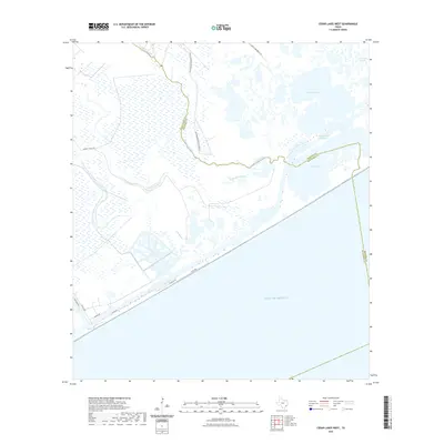
2022 Map of Cedar Lakes West
USGS Topo · Published 2022About this map
The San Bernard Wildlife Refuge dominates this coastal Texas landscape, preserving a complex environment of marshes and tidal waters at the boundary of Matagorda and Brazoria counties. This 2022 survey captures the modern configuration of the Intracoastal Waterway as it cuts through the marshlands north of the Gulf shore. The natural hydrology is defined by the wandering path of Cedar Lake Creek and the expansive brackish basins of Cowtrap Lake and the Cedar Lakes.
Find a feature on this map
19 named features on this map. Tap any name to fly to it.
Don’t see what you’re looking for? This feature index may not catch every label — zoom into the map to look around manually.
Map Details
Editions of this 2022 Cedar Lakes West Map
This is the sole edition of this map. No revisions or reprints were ever made.
Other maps of this area

1943 · Jones Creek
USGS Topo · 1:31,680

1943 · Cedar Lakes East
USGS Topo · 1:24,000

1951 · Bay City
USGS Topo · 1:250,000

1952 · Cedar Lane NE
USGS Topo · 1:24,000

1952 · Cedar Lakes West
USGS Topo · 1:24,000
1952 · Brown Cedar Cut
USGS Topo · 1:24,000

1952 · Cedar Lane
USGS Topo · 1:24,000

1952 · Sargent
USGS Topo · 1:24,000

1956 · Bay City
USGS Topo · 1:250,000

1958 · Bay City
USGS Topo · 1:250,000