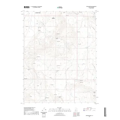
2020 Map of Cedar Mountain
USGS Topo · Published 2020About this map
Cedar Highlands sits atop the high plateau south of Cedar City, where the abrupt verticality of the Hurricane Cliffs gives way to a complex landscape of summits and hollows. This recent survey illustrates the modern road network, including the Kolob Rd and Kanarra Rd, which provide access to high-elevation terrain near Three Knolls Summit and Kanarra Mtn. The hydrology of the area is defined by numerous seasonal drainages and springs, such as Murie Cr, Hicks Cr, and Day Spring, which carve through deep depressions like Death Hollow and Spanish Hollow. Geologic landmarks such as The Pyramids and Sugarloaf Mtn stand as distinctive navigational points. The map provides a clear record of land use and naming conventions at the edge of the Iron County plateau, from the residential enclave at Cedar Highlands to the remote reaches of Oak Spring Flat.
Find a feature on this map
54 named features on this map. Tap any name to fly to it.
Don’t see what you’re looking for? This feature index may not catch every label — zoom into the map to look around manually.
Map Details
Editions of this 2020 Cedar Mountain Map
This is the sole edition of this map. No revisions or reprints were ever made.
Other maps of this area

1885 · St. George
USGS Topo · 1:250,000

1886 · Kanab
USGS Topo · 1:250,000

1891 · St. George
USGS Topo · 1:250,000

1949 · Cedar City NW
USGS Topo · 1:24,000

1950 · Cedar City NW
USGS Topo · 1:24,000

1950 · Kanarraville
USGS Topo · 1:24,000

1950 · Cedar City
USGS Topo · 1:24,000

1950 · Cedar City
USGS Topo · 1:62,500

1950 · Cedar Mountain
USGS Topo · 1:24,000

1951 · Kanarraville
USGS Topo · 1:24,000