
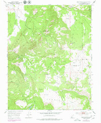
1950 Map of Cedar Mountain
USGS Topo · Published 1974About this map
Cedar Mountain and the towering Hurricane Cliffs dominate this high-altitude landscape of southern Utah. Surveyed in the late 1940s, the map reveals a remote industrial and agricultural frontier defined by small-scale resource extraction. Evidence of the region’s carbon history is found at the Tucker Coal Mine in the northeast and scattered Coal Mines in Blue Valley. Water management is critical in this arid terrain, as seen at the Meadow Reservoir and numerous isolated water sources like Cooks Spring, Oak Spring, and Pine Spring. The presence of a Tramway and Pipe Line indicates the effort required to transport materials and water across steep topographic changes. Distinctive geological features like Sugarloaf Mtn, Graff Pt, and Square Mountain provide prominent landmarks for navigation across the ridges and canyons of Shurtz Creek and Urie Creek.
Find a feature on this map
42 named features on this map. Tap any name to fly to it.
Don’t see what you’re looking for? This feature index may not catch every label — zoom into the map to look around manually.
Map Details
Editions of this 1950 Cedar Mountain Map
2 editions found
Other maps of this area

1885 · St. George
USGS Topo · 1:250,000

1886 · Kanab
USGS Topo · 1:250,000

1891 · St. George
USGS Topo · 1:250,000

1949 · Cedar City NW
USGS Topo · 1:24,000

1950 · Cedar City NW
USGS Topo · 1:24,000

1950 · Kanarraville
USGS Topo · 1:24,000

1950 · Cedar City
USGS Topo · 1:24,000

1950 · Cedar City
USGS Topo · 1:62,500

1951 · Kanarraville
USGS Topo · 1:24,000

1952 · Cedar Mountain
USGS Topo · 1:24,000