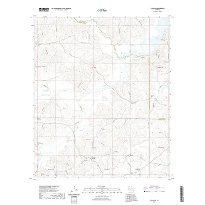
2020 Map of Cedarton
USGS Topo · Published 2020About this map
Mineral Springs and Cedarton are central to this landscape at the intersection of Union and Lincoln Parishes. The area is defined by a dense network of watercourses, most notably the winding Middle Fork Bayou D'Arbonne and Bayou D'Arbonne Lake in the northeast. Numerous family and community burial grounds, such as Colvin Barmore Cem, Colvin G H Cem, and Culbertson Cem, indicate long-standing local lineage and small, dispersed settlements. The land is segmented by numerous creeks including Cypress Cr, Smith Cr, and Sixteen Br, reflecting a terrain deeply carved by drainage. Rural connectivity is maintained through a web of parish roads like Parish Rd 570 and Parish Rd 503, which link isolated homesteads and local landmarks like the Rock Corner Cem across the wooded hillsides.
Find a feature on this map
81 named features on this map. Tap any name to fly to it.
Don’t see what you’re looking for? This feature index may not catch every label — zoom into the map to look around manually.
Map Details
Editions of this 2020 Cedarton Map
This is the sole edition of this map. No revisions or reprints were ever made.
Other maps of this area

1950 · Ruston
USGS Topo · 1:62,500

1951 · Ruston
USGS Topo · 1:62,500

1951 · Bernice
USGS Topo · 1:62,500

1952 · Calhoun
USGS Topo · 1:62,500

1952 · Farmerville
USGS Topo · 1:62,500

1955 · Shreveport
USGS Topo · 1:250,000

1956 · Shreveport
USGS Topo · 1:250,000
1982 · Downsville North
USGS Topo · 1:24,000
1982 · Downsville South
USGS Topo · 1:24,000

1984 · Shreveport
USGS Topo · 1:250,000